Free online GIS beginner course, starts 14 June
VerdantLearn's new course 'Introduction to GIS for conservation' starting Monday 14 June is open for registration at https://verdantlearn-courses.webflow.io/gis-beginners
This free part-time online course is aimed at conservation professionals & students. It's designed for complete beginners, but it would also suit those who want to refresh their knowledge, switch from ArcGIS to QGIS, or would like a reason to practice rusty skills!
Dates & times:
- Monday 14 June to Sunday 11 July
- 4 weeks part-time - 4-5 hours/week at a time to suit you
- Deadline: Register by 17:00 UTC on Monday 14 June to gain access
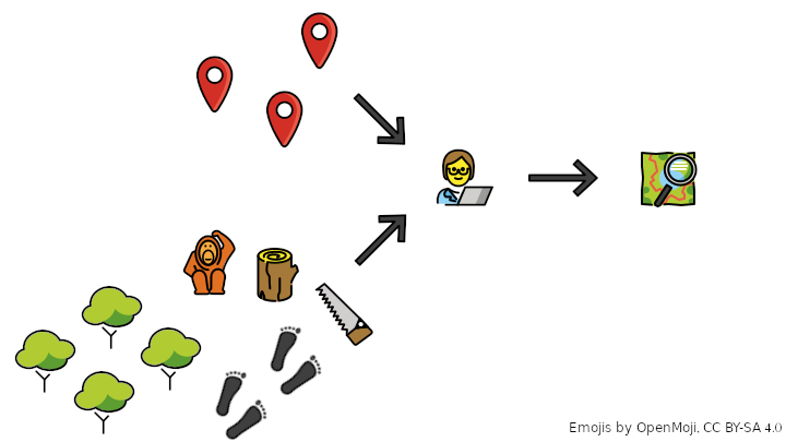
We'll cover both the hands-on skills and the conceptual underpinning necessary to effectively overlay and visualise spatial data. The course is tutor-led, with the opportunity to form learning circles for peer-support. We'll be using QGIS - a free, open source GIS software similar to ArcGIS.
By the end of the course, you will be able to:
- Create a GIS project to combine your field observations with free environmental data
- Visualise your field data effectively
- Distinguish between vector and raster data formats
- Overlay data using different spatial reference systems
- Create maps that clearly communicate your message
This course is offered for free as my commitment to Open Education for a Better World 2021.
Please share widely within your networks to ensure word reaches all those who might benefit! Thank you
Affordable, flexible and sociable online learning in technical skills for conservation and open education. Support for virtual and hybrid conferences and events

Please sign in or register for FREE
If you are a registered user on WildHub, please sign in
Thanks Lucy, this is great :) I've signed up!
Thanks for posting, Lucy! I've shared with some folks already.