Application of GIS in Conservation Mapping - RCoE
The Regional Centre of Excellence (RCoE) | https://rcoe-geoportal.rcmrd.org/
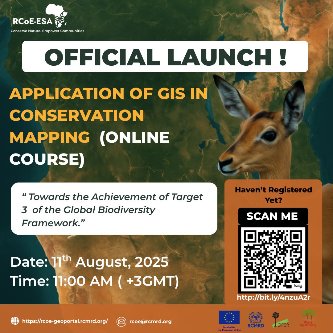
Official Launch Alert!
We’re excited to announce the launch of our online course:
Application of GIS in Conservation Mapping
Date: 11th August 2025
Time: 11:00 AM (GMT+3)
This course supports efforts “Towards the Achievement of Target 3 of the Global Biodiversity Framework.”
Whether you're a conservationist, GIS enthusiast, or environmental planner, this course is designed to equip you with the tools to map, analyse, and protect biodiversity using spatial data.
Register now: https://rcoe-geoportal.rcmrd.org/pages/gis-in-conservation-mapping
Don’t miss it, scan the code in the poster or click the link above to secure your spot!
#GISForConservation #BiodiversityMapping #RCMRD #RCoE #Target3 #KunmingMontreal #GeospatialSolutions #OnlineLearning
LinkedIn Post: https://www.linkedin.com/feed/update/urn:li:activity:7354033922902523906/
Credits: In Image

I have always believed that kindness should extend to every living being. My love for animals and nature is not just a passion. It is a part of who I am. I care deeply about Animal Rights, Welfare, and Wildlife Conservation, and I do whatever I can to make this world a gentler and safer place for them. Whether it is raising awareness or supporting meaningful causes, I try to play my part with heart and purpose.
Professionally, I have grown as an Executive Assistant and Administrative Specialist with hands-on experience across different sectors and cultures. Over the years, I have worked closely with senior leadership teams in Technology, Business, and Higher Education, always striving to be dependable, professional, and calm under pressure. I have earned an Advanced Certificate in Executive Assistance from BMTG UK Ltd which reflects my dedication to this profession.
I have also completed several training programs focused on workplace excellence and strong organizational skills. These skills help me adapt to change and keep things running smoothly in today’s fast-paced world. My work often involves managing international travel, planning both virtual and on-site events, and handling communication, immigration, and hospitality tasks. I approach each of these with care and a personal touch.
I also write professionally, preparing internal communications and business correspondence with clarity and precision. This has helped me build a reputation for being trustworthy, effective, and committed to high standards.
What truly keeps me going is my willingness to learn and grow. I believe that every day is an opportunity to do better, not just at work, but in how we treat others, especially those who do not have a voice. This journey of compassion, hard work, and lifelong learning is what I carry forward, wherever I go and whatever I do.

Please sign in or register for FREE
If you are a registered user on WildHub, please sign in